On July 13, 2021, the Dixie Fire started in the mountains of northern California, near Lake Tahoe, and soon grew to one of the largest and most destructive wildfires in the state’s history. The fire burned over 960,000 acres, destroyed over 1,200 structures, and forced tens of thousands of people to evacuate their homes. But its uncontrollable fire behavior, size, and destructions were not unprecedented; what makes the Dixie Fire unique is that for the first time in the recorded history, a wildfire climbed up the Sierras, jumped the mountain crest, and burned on both sides of the range. As the fire burned through lower elevations, the presence of dry vegetation, hot and dry conditions, and strong winds further fueled the fire and carried it to higher elevations. The Dixie Fire serves as a stark reminder of the devastating impacts of global warming, which are causing fires to spread to higher elevations.
Fire danger reflects the potential, over a large area, for a fire to ignite, spread and require suppression action. Fire danger is driven by water and energy balance. Background warming and climatic change increased fire danger in many regions worldwide, but impacts are not homogenous everywhere. Previous studies indicated larger sensitivity of mesic regions to fire. Recent research shows that background warming weakened the high-elevation flammability barrier – which historically slowed down or stopped spread of fires to higher elevations. This enabled fires to advance uphill and caused high-elevation fires unprecedented in modern times.
In this study, we analyzed how fire danger changed with elevation in 15 mountainous ecoregions of the western United States between 1979 and 2020. Our research aimed to answer two questions: 1) Did fire weather intensification depend on elevation? and if so, 2) Did critical fire danger synchronize across elevation? To this end, we used daily meteorological and fire danger indices to determine the trends in warm-season averages and identify the number of critical fire danger days. Each ecoregion was divided into land areas that were enclosed in 500 m elevation bands to examine the elevation-dependent trends.
Elevation-dependent fire weather intensification
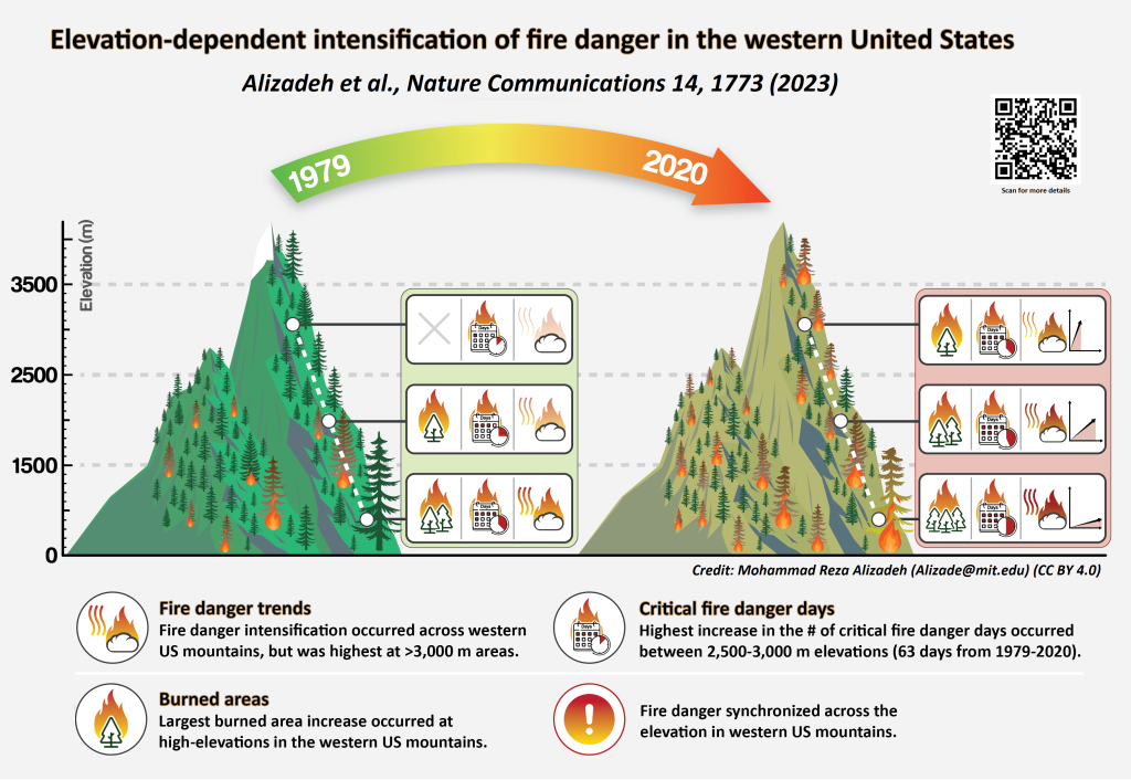
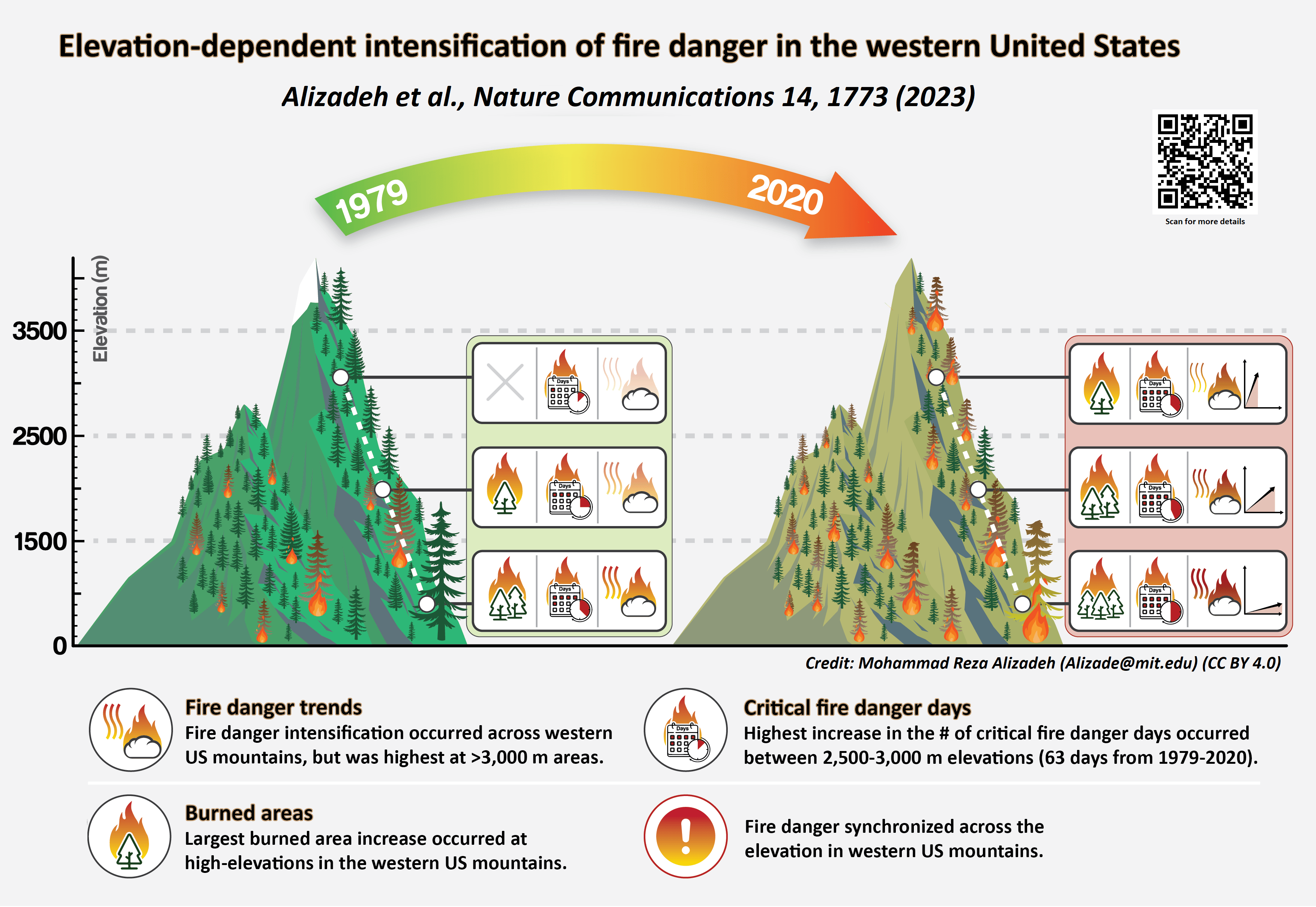
Over the past four decades, the western US has experienced marked warming and drying trends, resulting in intensified fire danger. Our study found that high-elevation areas in mountainous regions have experienced more pronounced fire danger trends than low-elevation areas. This suggests that historically wet high-elevations became increasingly more prone to large fire activity in recent years. This trend is expected to continue in a warming and drying climate. We found that in 13 of the 15 mountainous regions studied, there was a larger increase in warm-season average Energy Release Component (ERC, a measure of potential fire behavior and fire danger) with increasing elevation. Similar trends were observed for other fire danger indices. We defined warm-season as May through September which are associated with pronounced wildfire activity across the western United States.
The warm-season average ERC in the most recent decade (2011-2020) was larger compared to the earliest decade (1981-1990) across all elevation bands and in all ecoregions. The decadal average ERC increased more significantly in higher elevations than in lower lands, with a median relative increase of 19% in elevations above 3,000 meter and a relative increase of 10% in the lowest elevations (0-500 meter).
Higher elevations experiencing more critical fire danger days
We analyzed changes in critical fire danger days, which are associated with high fire activity and potential for fire growth. We documented concerning trends in critical fire danger days, especially at higher elevations. We discovered that critical fire danger days increased across all elevation levels and ecoregions from 1979 to 2020; but, the largest increase occurred at elevations between 2,500-3,000 meters, where the number of critical fire danger days increased by 63 days from 1979-2020, 22 of which happened outside of the warm season. Meanwhile, the smallest increase occurred at the lowest elevations, between 0-500 meters, where there were 22 additional critical fire danger days over 42 years. In 10 out of the 15 studied ecoregions, higher elevations experienced a greater rate of increase in critical fire danger days compared to lower elevations. Our results showed that a marked portion of this increase in critical fire danger days occurred outside of the warm-season, particularly in the southern ecoregions. We also documented that in a warming climate, critical fire danger days synchronized across the elevation gradient, implying a diminished elevational fire danger relief.

Environmental and societal implications
Elevation-dependent fire danger intensification has significant implications for the ecological and hydrological functioning of mountainous ecosystems, as well as wildfire management in the rugged terrain of the highlands. Mesic forests of high-elevation areas are associated with long fire return intervals (ranging from several decades to thousands of years). But upon burning, these mesic forests experience intense, stand replacing and destructive fires. The frequent occurrence of high-elevation fires, enabled by elevation dependent fire danger intensification, can alter the composition, structure, population, and community characteristics of these forests. Ecosystem services that emanate from these high-elevation areas, for example, water, are also widely impacted by high-elevation fires. Furthermore, the intense burning of mesic forests and rugged terrain make fire management specifically difficult in highlands. Synchronization of critical fire danger across elevation provides more geographic opportunities for fires to start and spread, and strain the already stressed fire management resources with significant short- to long-term and immediate- to far-reaching repercussions. Climate emergency efforts and wildfire management planning should take into account this emerging hazard.


